Organizing Chair: Prof. B S Daya Sagar, ISI, Bangalore
| Time (IST) | Date: Dec 1, 2020 | |||||
|---|---|---|---|---|---|---|
| 9:30 to 12:30 | Tutorial 1: Polarimetry | Tutorial 2: Random Forest | ||||
| 14:00 to 17:00 | Tutorial 1: Polarimetry (cotd.) | Tutorial 3: Machine Learning | Tutorial 4: GNSS Reflectometry | Tutorial 5: Natural Disaster | Tutorial 6: HPC in hyperspectral Remote sensing | |
Participant can select any one or a combination of tutorials: T 1 or T2+T3/T2+T4/ T2+T5/ T2+T6
Session Managers: Urvi Shroff, Aditya Saraswat
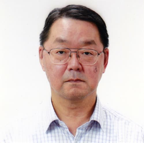
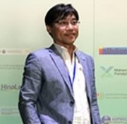
Yoshio Yamaguchi received BE degree in electronics engineering from Niigata University, Niigata, Japan, in 1976 and ME and Dr. Eng. degrees from Tokyo Institute of Technology, Tokyo, Japan, in 1978 and 1983, respectively. He is a Professor Emeritus and Fellow of Niigata University after his retirement in 2019. He is also an invited researcher at National Institute of Advanced Industrial Science and Technology (AIST), Japan.
Dr. Yamaguchi has served as Chair of IEEE Geoscience & Remote Sensing Society (GRSS) Japan Chapter (2002–03), Chair of International Union of Radio Science Commission F Japan Committee (URSI-F) Japan (2006–2011), Associate Editor for Asian affairs of GRSS Newsletter (2003–07), and Technical Program Committee (TPC) Co-Chair of the 2011 IEEE International Geoscience and Remote Sensing Symposium (IGARSS). He is a Life Fellow of IEEE and a Fellow of the Institute of Electronics, Information and Communication Engineers (IEICE), Japan, and a recipient of 2008 IEEE GRSS Education Award “in recognition of significant educational contributions to Geoscience and Remote Sensing Society” and 2017 IEEE GRSS Distinguished Achievement Award “for contributions to Polarimetric Synthetic Aperture Radar Sensing & Imaging and its Utilization”.
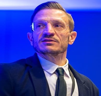
Dr. Carlos Lopez-Martinez received the MSc. degree in electrical engineering and the Ph.D. degree from the UniversitatPolitècnica de Catalunya, Barcelona, Spain, in 1999 and 2003, respectively.
Dr. Lopez-Martinez is Associate Professor in the area of remote sensing and microwave technology in the UniversitatPolitècnica de Catalunya, Barcelona, Spain. He has a large professional international experience at DLR (Germany), at the University of Rennes 1 (France), and as a group leader of the Remote Sensing and Natural Resources Modelling team in the Luxembourg Institute of Science and Technology (Luxembourg). His research interests include Synthetic Aperture Radar (SAR) theory, statistics and applications, multidimensional SAR, radar polarimetry, physical parameter inversion, advanced digital signal processing, estimation theory, and harmonic analysis.
Dr. López-Martínez has authored more than 200 articles in journals, books, and conference proceedings, and received the EUSAR 2002 Conference Student Prize Paper Award, co-authored the paper awarded with the EUSAR 2012 Conference First Place Student Paper Award, and received the IEEE-GRSS 2013 GOLD Early Career Award. Dr. López-Martínez has broad academic teaching experience from bachelor, master, and Ph.D. levels to advanced technical tutorials presented at international conferences and space and research institutions worldwide. He is an associate editor of the IEEE-JSTARS journal and the MDPI Remote Sensing, acting also as invited guest editor for several special issues. He has collaborated in the Spanish PAZ and the ESA’s SAOCOM-CS missions, in the proposal of the Parsifal mission and he is member of the ESA’s Sentinel ROSE-L Mission Advisory Group. He was appointed vice-president of the IEEE-GRSS Spanish chapter, and in 2016 he became its secretary and treasurer. From 2011 Dr. López-Martínez collaborates with the IEEE-GRSS Globalization initiative in Latin America, contributing to the creation of the IEEE-GRSS Chilean chapter and the organization of the 2020 LAGIRSS conference, being appointed as Latin America liaison in 2019. He is also co-chair of the Tutorial Technical Committee of the Indian 2020 InGARSS conference.
Nowadays, several space borne Polarimetric Synthetic Aperture Radar (PolSAR) systems are in operation as TerraSAR-X (X-Band) launched in June 2007, RADARSAT-2 (C-Band) launched in December 2007, Sentinel-1A&B (C-band) launched in April 2014, ALOS-2 (L-band) launched in May 2014. Also, future missions as BIOMASS (P-band), SAOCOM (L-band), RCM (C-band) and GF3&10 (C-Band) are designed to have parametric sensitivity.
The availability of spaceborne PolSAR data provides an unprecedented opportunity for applying advanced PolSAR information processing techniques to the important tasks of environmental monitoring and risk management. PolSAR remote sensing offers an efficient and reliable means of collecting information required to extract quantitative geophysical and biophysical parameters from Earth’s surface. This remote sensing technique has found many successful applications in crop monitoring and damage assessment, in forestry clear cut mapping, deforestation and burn mapping, in land surface structure (geology) land cover (biomass) and land use, in hydrology (soil moisture, flood delineation), in sea ice monitoring, in oceans and coastal monitoring (oil spill detection) etc. The scope of different applications is increasing nowadays thanks to the availability of mulitemporal and polarimetric acquisitions.
SAR Polarimetry represents today a very active area of research in Radar Remote Sensing, and for instance operational polarimetric applications start to be operational in the frame of the Sentinel-1. Consequently, it becomes important to train and to prepare the future generation of researchers to this very important topic.
Session Managers: Dr Bindi Dave
Amir Behnamian received the Ph.D. degree in environmental engineering from University of Ottawa, Ottawa, ON, Canada in 2015.,He joined Environmental and Climate Change Canada, National Wildlife Research Centre, as Physical Scientist in 2016.,His research interest includes machine learning, land cover classification and monitoring using remote sensing, and environmental flow modeling.
Sarah N. Banks received the B.A. degree (Hons.) and the M.Sc. in physical geography from Carleton University, in 2009 and 2012.,She joined Environment and Climate Change Canada, Ottawa, ON, Canada, as Physical Scientist in 2014.,Her research interests include land cover mapping and change detection of Arctic and wetland ecosystems using polarimetric Synthetic Aperture Radar and machine learning techniques.
Koreen Millard completed B.A. (Bishop's University), M.Sc. (Acadia University), Ph.D. (Carleton). Her research sits at a crossroads between geomatics, physical geography and big data science. Primarily her research is focused on ecosystem monitoring and extraction of biophysical parameters from remotely sensed imagery, but she also critically assess how bias and uncertainty can affect the use of these tools in a variety of landscapes. By coupling remote sensing with extensive monitoring in the field, her research helps detangle hydrological, vegetation and climate interactions so that we can better predict the responses of wetlands and northern ecosystems to change.
To achieve effective land cover classification with the Random Forest algorithm, users need to address the challenges related to training/validation data and predictor variable selection. Considering the recent availability of free temporal data streams from different sensors (e.g., optical and/or SAR), users can possibly generate a large number of predictor variables for a given classification problem. However, recent studies have shown that only a few of the generated variables from complementary sensors with the correct temporal combination will be adequate to generate products with high per class accuracies. This is mainly because the separability of the classes in a given problem is dependent on the selection of the correct predictor variables. For example, previous studies have shown that the variable importance measures, such as the Gini index or the mean decrease in accuracy, might be biased in the presence of correlated variables, making variable selection a challenging task in operational settings. The objective of this tutorial is to provide in-depth insights by showing and discussing some classification test cases using Random Forests on the basis of our previous research. Additionally, some of the challenges and solutions for operational land cover classification over large study areas using different platforms such Google Earth Engine are discussed.
Session Managers: Suchit Purohit

Dr. Ronny Hänsch received the Diploma degree in computer science and the Ph.D. degree from the Technische Universität Berlin, Berlin, Germany, in 2007 and 2014, respectively. From 2019, he works as senior researcher at the German Aerospace Center. His research interests include computer vision, machine learning, object detection, neural networks, and ensemble theory. He worked in the field of image-based object detection and classification with a focus on remote sensing data and in particular polarimetric synthetic aperture radar images as well as image-based 3D reconstruction. His teaching experience includes tutoring the practical exercises of Digital Image Processing, Automatic Image Analysis, and Photogrammetric Computer Vision as well as several projects and seminars at the TU Berlin since 2010, giving the lectures of Digital Image Processing at the TU-Berlin since 2013 as well as Introduction to Computer Science at the Turkish-German University in 2016-2017, and organizing multiple tutorials on Machine Learning in Remote Sensing at international conferences (e.g. IGARSS, EUSAR, Whispers). He currently serves as Associate Editor of the IEEE Geoscience and Remote Sensing Letters and as co-chair of the ISPRS Working Group II/1 Image Orientation as well as of the IEEE GRSS Technical Committee Image Analysis and Data Fusion.
Despite the wide and often successful application of machine learning techniques to analyze and interpret remotely sensed data, the complexity, special requirements, as well as selective applicability of these methods often hinders to use them to their full potential. The gap between sensor- and application-specific expertise on the one hand, and a deep insight and understanding of existing machine learning methods on the other hand often leads to suboptimal results, unnecessary or even harmful optimizations, and biased evaluations. The aim of this tutorial is threefold: First, to provide insights and a deep understanding of the algorithmic principles behind state-of-the-art machine learning approaches including Random Forests and Convolutional Networks. Second, to illustrate the benefits and limitations of machine learning with practical examples. Third, to inspire new ideas by discussing unusual applications from remote sensing.
Session Managers: Alpana Shukla
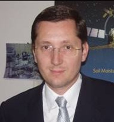
Adriano Camps was born in Barcelona, Spain, in 1969. In 1993 he joined the Electromagnetics and Photonics Engineering Group, Department of Signal Theory and Communications, UPC, as an Assistant Professor, Associate Professor in 1997, and Full Professor since 2007. In 1999, he was on sabbatical leave at the Microwave Remote Sensing Laboratory, of the University of Massachusetts, Amherst. His research interests are focused in microwave remote sensing, with special emphasis in microwave radiometry by aperture synthesis techniques (MIRAS instrument onboard ESA’s SMOS mission), remote sensing using signals of opportunity (GNSS-R), and nanosatellites as a tool to test innovative remote sensors. He has published over 212 papers in peer-reviewed journals, 7 book chapters and the book Emery and Camps, “Introduction to Satellite Remote Sensing. Atmosphere, Ocean, Land and Cryosphere Applications,” Elsevier, 2017, 860 pages), and more than 453 conference presentations, holds 10 patents, and has advised 25 Ph. D. Thesis students (+ 10 on-going), and more than 140 final project and M.Eng. Theses. According to Google Scholar/Scopus his h-index is 49 / 38, and his publications have received more than 10250/6895 citations.
Although originally designed for navigation, signals from the Global Navigation Satellite System (GNSS), i.e. GPS, GLONASS, Galileo and COMPASS, exhibit strong reflections from the Earth and ocean surface. Effects of rough surface scattering modify the properties of reflected signals. Several methods have been developed for inverting these effects to retrieve geophysical data such as ocean surface roughness (winds) and soil moisture. Extensive sets of airborne GNSS-R measurements have been collected over the past 15 years. Flight campaigns have included penetration of hurricanes with winds up to 60 m/s and flights over agricultural fields with calibrated soil moisture measurements. Fixed, tower-based GNSS-R experiments have been conducted to make measurements of sea state, sea level, soil moisture, ice and snow as well as inter-comparisons with microwave radiometry.
GNSS reflectometry (GNSS-R) methods enable the use of small, low power, passive instruments. The power and mass of GNSS-R instruments can be made low enough to enable deployment on small satellites, balloons and UAV’s. Early research sets of satellite-based GNSS-R data were first collected by the UK-DMC satellite (2003), UK Tech Demo Sat-1 (2014) and the 8-satellite NASA CYGNSS constellation (2016). ESA GEROS-ISS (GNSS ReEflectometry, Radio-Occultation and Scatterometry on the International Space Station) was meant to demonstrate GNSS-R altimetry. FFSCat, 2017 Copernicus Masters overall winner, will be launched on September 1st, 2020 and will try to combine GNSS-R, L-band microwave radiometry and hyperspectral data for sea ice and soil moisture applications… Availability of spaceborne GNSS-R data and the development of new applications from these measurements, is expected to increase significantly following launch of these new satellite missions.
Actually, GNSS-R can be understood as a multi-static radar using navigation signals, but recently, some of the methods have been applied to other satellite transmissions in other frequencies, ranging from P-band(230 MHz) to K-band (18.5 GHz). So-called “Signals of Opportuinty” (SoOp) methods enable microwave remote sensing outside of protected bands, using frequencies allocated to satellite communications. Measurements of sea surface height, wind speed, snow water equivalent, and soil moisture have been demonstrated with SoOp.
In this tutorial, the principles, applications and current/planned GNSS-R and SoOp missions will be presented.
Session Managers: Indrani Choudhury Singh
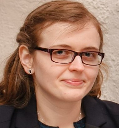
Dr. Ramona Pelich received a B.S. degree and an M.S. degree in signal and image processing from both the “TraianVuia” Polytechnic Institute of Timisoara, Romania and the Institut Mines Télécom, Télécom Bretagne, France, in 2010 and 2012, respectively. She received her Ph.D. degree in remote sensing and image processing from the Institut Mines Télécom, Télécom Bretagne in 2015. Between 2012 and 2015, she was with CollecteLocalisation Satellites, France and the Institut Mines Telecom, Télécom Bretagne, working on ship detection and characterization from Synthetic Aperture Radar (SAR) imagery linked with cooperative vessel tracking data. In 2016 she joined the Environmental Research and Innovation (ERIN) Department, Luxembourg Institute of Science and Technology, Luxembourg. Her research interests include signal and image processing techniques applied to remote sensing data. The developed scientific algorithms are applied in different fields such as large-scale flood hazard mapping, vessel detection, urban mapping, etc.
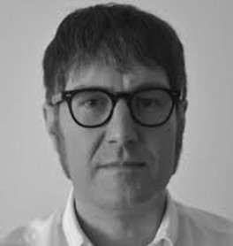
Dr. Marco Chini received the M.Sc. degree in electronic engineering from the University of Rome “La Sapienza,” Rome, Italy, in 2003, and the Ph.D. degree in geophysics from the University of Bologna, Bologna, Italy, in 2008. From 2003 to 2012, he collaborated with the Department of Information Engineering, Electronics and Telecommunications, University of Rome “La Sapienza.” From 2006 to 2008, he was a Visiting Researcher with the University of Colorado, Boulder, CO, USA. From 2008 to 2012, he was with the Remote Sensing Group, Istituto Nazionale di Geofisica e Vulcanologia, Rome. Since 2013, he has been with the Luxembourg Institute of Science and Technology, Belvaux, Luxembourg. His research interests include the analysis of multitemporal data, classification, feature extraction, and data fusion and segmentation using optical and synthetic aperture radar data, including interferometry technique for geophysical applications. Dr. Chini is an Associate Editor of the IEEE TRANSACTIONS ON GEOSCIENCE AND REMOTE SENSING and an Editorial Advisor for Springer’s publication program in remote sensing, and served on the editorial board of data set papers in geosciences.
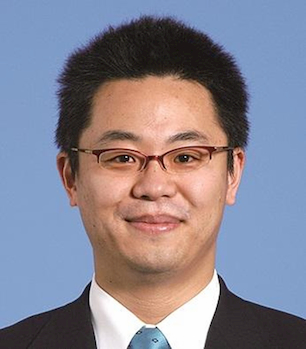
Prof. Wataru Takeuchi is currently a full Professor at Institute of Industrial Science (IIS), University of Tokyo, Japan. He obtained Bachelor degree in 1999, Master degree in 2001, and PhD degree in 2004 at Department of Civil Engineering, the University of Tokyo, Japan. He has worked at IIS since 2004 as a Postdoctoral fellow. He was a Visiting Assistant Professor at Asian Institute of Technology (AIT), Thailand from 2007 to 2009. He was also Director of Japan Society for Promotion of Science (JSPS), Bangkok office, Thailand during the period 2010-2012. His current research interests consist of remote sensing and GIS, global land cover and land use change, global disaster monitoring, global carbon cycling, and Management and policy for terrestrial ecosystems.
Dr. Young-Joo Kwak received the Ph.D. in Science from Chiba National University, Japan, in 2010. He is currently working as a research officer at National Institute for Land and Infrastructure Management (NILIM) under Ministry of Land, Infrastructure and Transport (MLIT), Japan. His main research interests are land and resilient infrastructure management for smart-society using advanced remote sensing and ICT&3D-GIS. At the International Centre for Water Hazard and Risk Management, under the auspices of UNESCO of the Public Works Research Institute (ICHARM-UNESCO-PWRI) where he worked for more than 8 years, his principal research interests were focused on the development of global and regional flood risk assessment methods, particularly for developing countries, in consideration of climate change and socio-economic impacts.
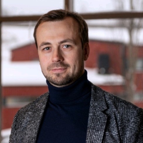
Dr. Vitaliy V. Yurchenko holds a master degree cum laude in theoretical physics from Donetsk National University (Ukraine) and a PhD degree from Charles University in Prague (Czech Republic). From 1999 to 2004 he was working on different aspects of condensed matter, mostly superconductivity and magnetism, at the Institute of Physics of the Academy of Science of the Czech Republic, and as a visiting researcher at the Research Center Juelich (Germany). From 2004 and on, he has been affiliated with the University of Oslo (Norway) first as a post-doctoral fellow and from 2013 as a guest-researcher. There he has been working mostly on visualization of critical phenomena in superconductors by means of magneto-optical imaging. Superconductors turned out to be a good model system for the studies of avalanches: a very special type of them - magnetic flux avalanches - occur in superconductors due to their inherent thermo-magnetic instability. In 2013 he joined a growing R&D company - ORG Geophysical - delivering electro-magnetic surveys to offshore oil and gas industry. In 2017 he headed a spin-off project – iGeo AS – to develop unmanned technology for mapping geohazards on land. At present Vitaliy is affiliated with HySpex division of NorskElektroOptikk – company producing hyperspectral instruments, iGeo AS – company developing technique and rendering services for on-site electromagnetic 3D scanning of geohazard sites, and as a guest researcher at the University of Oslo. His current focus is on integrating earth observation data (multispectral, InSAR, PolSAR) into workflow for early detection and monitoring of landslides, and combine it with on-site surveys. Vitaliy’s academic record is 35+ articles in peer-reviewed journals and more than 50 conference contributions.
In recent years, natural disasters, i.e., hydro-geo-meteorological hazards and risks, have been frequently experienced by many countries across the globe. 2019 has been another year with numerous devastating disasters hitting several regions. For example, in the Bahamas, Hurricane Dorian caused massive flooding with significant damages, while Japan has been affected by cascading and interacting hazards such as catastrophic mudslides and devastating floods caused by Typhoon Hagibis. As well in 2019, north-east India was suffering badly from monsoon-related flooding and landslides as Ganga and Bagmati Rivers swell up due to heavy rainfall. This tutorial is comprised of basic theoretical and experimental information essential for an emergency hazard and risk mapping process focused on advanced satellite Earth Observation (EO) data including both SAR and Optical data. Firstly, this tutorial gives a better understanding of disaster risk in the early stage by means of EO data available immediately after a disaster occurs. Then, after several comprehensive lectures focused on floods and landslides, a hands-on session will give the opportunity to all participants to learn more about the practical EO tools available for rapid-response information.
This tutorial will demonstrate the implementation of disaster risk reduction and sustainable monitoring for effective emergency response and management between decision and action activities.
Session Managers: Dr Bindi Dave
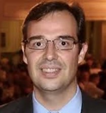
Antonio Plaza received the M.Sc. and Ph.D. degrees in computer engineering from the University of Extremadura, Badajoz, Spain, in 1999 and 2002, respectively.
He is the Head with the Hyperspectral Computing Laboratory, Department of Technology of Computers and Communications, University of Extremadura. He has authored more than 600 publications, including more than 200 JCR journal papers (more than 160 in IEEE journals), 23 book chapters, and around 300 peer-reviewed conference proceeding papers. He has guest edited ten special issues on hyperspectral remote sensing for different journals. His main research interests include hyperspectral data processing and parallel computing of remote sensing data.
Prof. Plaza is a Fellow of the IEEE for contributions to hyperspectral data processing and parallel computing of Earth observation data. He was the recipient of the recognition of Best Reviewers for the IEEE GEOSCIENCE AND REMOTE SENSING LETTERS in 2009 and for the IEEE TRANSACTIONS ON GEOSCIENCE AND REMOTE SENSING in 2010, for which he served as an Associate Editor during 2007–2012. He is also an Associate Editor for the IEEE ACCESS (receiving a recognition as the Outstanding Associate Editor of the journal in 2017), and was a Member of the Editorial Board of the IEEE GEOSCIENCE AND REMOTE SENSING NEWSLETTER (2011–2012) and the IEEE GEOSCIENCE AND REMOTE SENSING MAGAZINE (2013). He was also a Member of the Steering Committee for the IEEE JOURNAL OF SELECTED TOPICS IN APPLIED EARTH OBSERVATIONS AND REMOTE SENSING (JSTARS). He was the recipient of the Best Column Award for the IEEE SIGNAL PROCESSING MAGAZINE in 2015, the 2013 Best Paper Award of the JSTARS journal, and the most highly cited paper (2005–2010) in the Journal of Parallel and Distributed Computing. He was also the recipient of the Best Paper awards at the IEEE International Conference on Space Technology and the IEEE Symposium on Signal Processing and Information Technology. He served as the Director of Education Activities for the IEEE Geoscience and Remote Sensing Society (GRSS) during 2011–2012, and as the President of the Spanish Chapter of the IEEE GRSS during 2012–2016. He has reviewed more than 500 manuscripts for more than 50 different journals. He served as the Editor-in-Chief for the IEEE TRANSACTIONS ON GEOSCIENCE AND REMOTE SENSING from 2013 to 2017.
The topic of this tutorial will be on remotely sensed hyperspectral images. Several techniques for classification, unmixing, compression and information extraction from these kind of images will be discussed, along with computationally efficient implementations of the aforementioned techniques using different kinds of high performance computing architectures. The tutorial will particularly discuss implementations for on-board processing, along with traditional parallelization frameworks.